- Held Spring Ride Gloves - January 5, 2026
- 100 Motorcycle Tours - December 27, 2025
- Bhutan Motorcycle Tour - December 9, 2025
How often can you say you went from one side of the country to the other in a day. How about back again same day. Welcome to Japan.
I did not set out to purposely to see two different oceans on the same day however leaving Nagoya bound west I entering the elevated expressway system and was faced with a fork in the road. Being somewhat stubborn I have been persisting with my existing out-dated GPS navigation and took the wrong turn thus ended up riding towards the port. It actually was a interesting road with many bridges and now I can also say I rode from the North Pacific ocean to the Sea of Japan.

Nagoya port
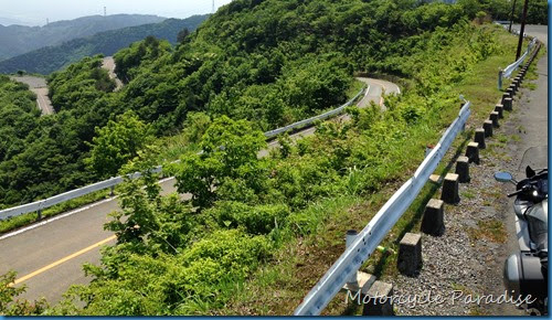
I actually attempted to ride to the Fukui district twice already. The first time I was not far into my ride and that old GPS of mine locked up as it sometimes does. However on this occasion it simply kept freezing so I was unable to continue. The Ibuki Driveway is a scenic mountain toll road and was close by to where I had stopped so I decided to take a look despite the expensive toll fee as otherwise I was just going to return home.


Ibuki Driveway

Nice enough ride but better roads for free. On my next outing to Fukui I had planned a route that ran further north first into the Gifu region. The route followed some interesting looking roads past two lakes. Japan has 1000’s of dams and as you ride into or away from the mountains you can enjoy both the scenic flowing streams and many dams as often the river will be dammed a number of times before it exits the valley for both hydro power generation and flood control.

Beautiful Gifu

Despite a fine forecast this is the rainy season and I took shelter from a downpour in one of the ‘snow sheds’ the cover the road in places then got out the wet weather gear. In the next mountain valley it was fine again so I stopped at a roadside rest area to have some lunch. Having luggage fitted to the bike I bring a cooler bag with drinks and sandwiches and choose a nice place to stop. Better than any cafe!


What a spot for lunch!
Next I came to what I thought was a road closure. There were many signs which seemed to say the road ahead was closed. I went on a bit not sure and then waited but not a single car came in either direction and looking at the fuel gauge did the math if there was no petrol in route and I had to backtrack. I was in a remote area so decided to play it safe.

Bridge built just to a picnic area back in another time. (now abandoned)
The road closure meant I had a large detour to make and also had to abandon my planned ride however I was optimistic the weather would improve so set a course on the GPS to Shiga to see Biwa lake, the largest in Japan. Arriving ahead of the rain behind me I enjoyed some superb views of Biwa lake from the Okubiwako Driveway, a scenic road on the northern edge of the lake.


Big lake. Also big drop off that edge!
If at first you don’t succeed… Third time I set off with yet another new route planned. South to Suzuka then across to the southern edge of Shiga lake near Kyoto. Would you be surprised if I said things did not go to plan. Riding up towards the Suzuka skyline the road is a joy on a motorcycle, but alas the road was closed due at the tunnel just as I was starting to enjoy it.


This was not good and in prompted me to look for a government site about road conditions for future. I backtracked and tried the detour button on my GPS which took me into a small hot spring resort town at the base. Besides the cable car to the top of Mt Gozaiho which was still popular with day trippers, the majority of the town had been abandoned. A ghost town built in another time. I returned to looked at this later and some of those photos appear in this post.


Abandoned town of Yunoyama, all the hotels below empty.


The view from above back to Yunoyama
The GPS wanted to just route me back to the Suzuka Skyline rather than look for new route. I think the detour mode is just for small road blocks. Time to navigate old school via map. Hmm well Google map was on my iPhone so not exactly old school but in the right spirit! I ended up on another large detour but the riding was still all good via another scenic road across the mountains to Shiga lake. It had a very long road tunnel right under the whole mountain before exiting to a pretty valley full of pine trees. I cut back south on farm roads to get onto on my original route much later in the day but determined to go on regardless. I was following what was designated a national major route.
It started out wide but this later turned into a very narrow and remote mountain pass that meandered all over the place like a sealed version of a forest access road. I am using Google street view more now in planning rides and find that the minor almost invisible roads on Google can in some cases be wide and well surveyed while the major road reduces to something unpassable. What I need is a good old fashioned touring atlas with road descriptions. Mapple make these specifically for riders so I shall get one soon but they are only in Japanese.


Everything is engineered, reminds me of Switzerland.
Eventually I start to exit the mountain and my second major descent for the day on route to the Sea of Japan. The narrow roads had been rather challenging and while I took some photos none captured the roads well. I was rewarded once at out of the hills with one of the best motorcycle rides I have yet had in Japan. A beautiful sweeping road wound its was along the valley floor and I knew immediately it was something special by the number of motorcycles I was passing going the other way. My photos again did not capture the road so here is a snapshot from Google.

Photo via Google
I pushed on as it was already 3.30pm and I was still not at my goal but from here it was not far to Obama bay and the first of two roads I was aiming for called Angel Scenic drive. It was once a toll road but the toll gate lay abandoned and I had the road to myself. And so I arrived at the Sea of Japan.


Obama Bay


Next stop North Korea
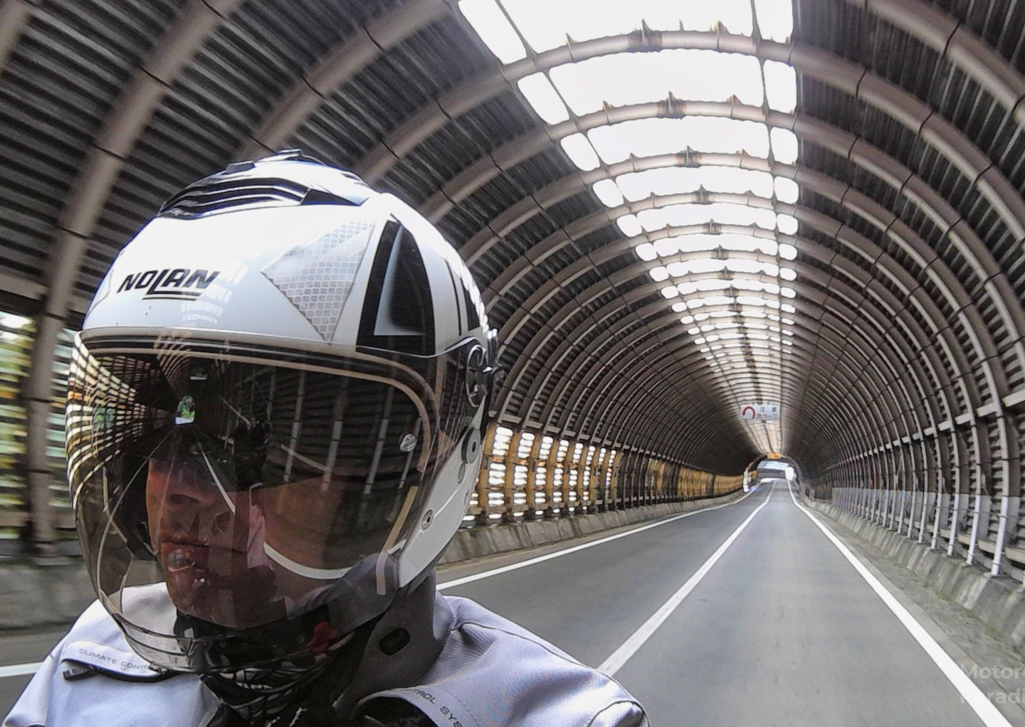
About now I was starting to feel tired and it was 4.00pm and I was on the other side of the country. I decided to say that’s enough and head for the nearest expressway onramp to go back home. The toll roads in Japan run elevated on structures or via massive tunnels right across the country and so are very direct and fast way to travel (albeit expensive) Safe for riding at night as no animals due the the elevated construction I was not concerned if I was back late as my time is my own.

Typical of the expressway system in Japan.
As it turned out the ride back on the expressway took only 3 1/2 hours plus a 15 minute coffee break at a highway service centre. I set the cruise control and the bike almost rode itself back. Exceptional bike on the highway, less so elsewhere. But that is another story.


Great photo's Warren. How come all the roads in Japan seem to be nearly empty except the toll ways?
How much was the toll way by the way, if you take the toll way all the way round sydney it will cost you $30-40 in tolls. Complete rort.
I'm enjoying your international motorcycle blogging. Keep it up.
Hey I never noticed your message before now. Main roads of course carry more traffic but the smaller roads are light and away from the towns people tend to jump on expressways. The expressways cost about $10 an hour roughly if going long way but have a minimum so if you get on you want to maximise the flag fall.
Some absolutely stunning views.
I've never given any thought to the type of roads in Japan….until now.