
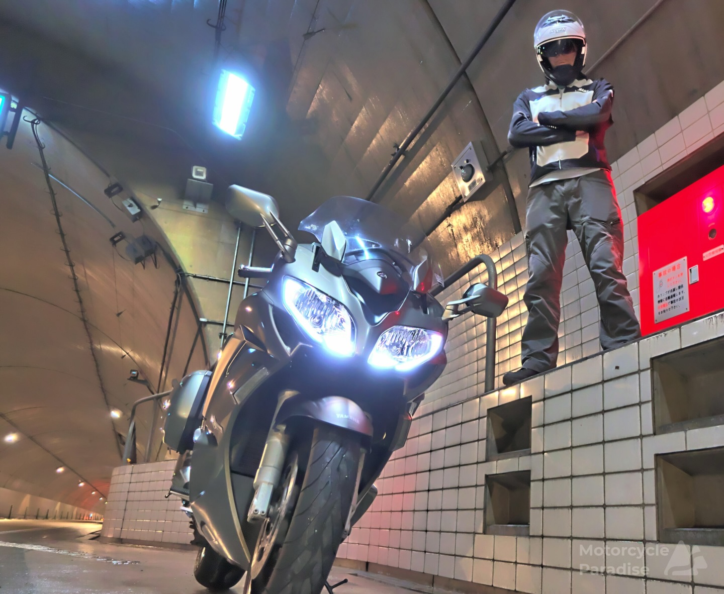
- Thin Air, Full Throttle - July 13, 2026
- Regular Tour Items - July 7, 2026
- Happy Birthday - June 18, 2026
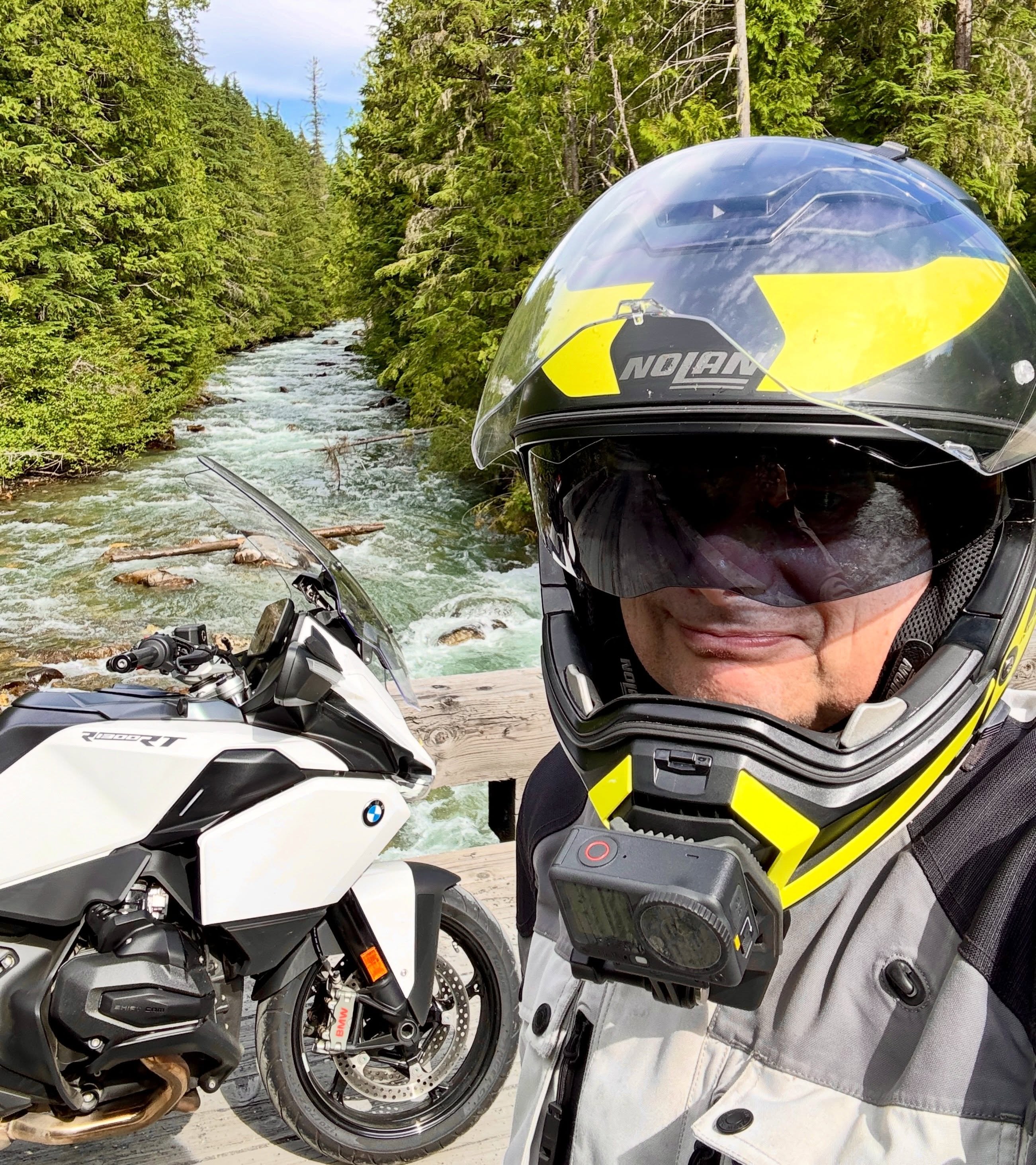
I have been a long time user of Ride with GPS. All my routes for all my motorcycle tours going back to around 2012 are made using this web based tool however since Mid 2023 I have started a transition to MRA Routeplanner.
UPDATE 2026 – My Route App doesn’t work in Asia which is not advertised and is very disappointing
There are a few reasons for this shift and also a couple of things slowing my move away from RWGPS however one of those is not a lack of Google Street view something I find essential for route planning and was missing in every other route planner I have tried but MRA Routeplanner has it.
Because I have made 100’s of routes with RWGPS I still find it faster to make quick draft routes with it but I am doubling up my work doing that since I now move all my routes over to MRA Routeplanner to inspect before I output anything to my Garmin and should just make the routes there.
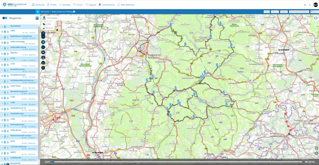
The main problem I have with RWGPS is GPX files it outputs mostly have poorly placed waypoints or other errors that confuse Garmins. When I import the files from RWGPS into MRA Routeplanner it is displayed as a Garmin would see the route and these problems are then easy to spot and fix before the file is exported to my Garmin. When I bring files from RWGPS to MRA I always need to fix many waypoints so it would be far quicker if I made the route error free in MRA Routeplanner to begin with which is where I am headed in the future.
Things I find missing in MRA Routeplanner so far is the ease of clearing an existing route on the screen and then creating the next route, a mini map preview of every route that RWGPS provides and the ability to combine many routes to a mini map for an overview of the entire tour – update found how to do that on MRA Routeplanner now also and with time I will find work around for other items.
On the other hand MRA Routeplanner is developed for motorcyclists while RWGPS has slowly become bicycle focused. MRA outputs GPX files my Garmin calculates and navigates perfectly and it has it’s own Navigator called MyRoute App which I have been trialing with reasonable success. I am not ready yet to attempt a ride overseas only using my phone but I am running this app in my pocket to my bluetooth speakers and comparing it’s turn by turn to the matching route in my Garmin and it keeps getting better and can handle me slightly missing waypoints like my Garmin does. I will update my phone next year and my old one might replace my ancient Garmin Nuvi 760 and 765.
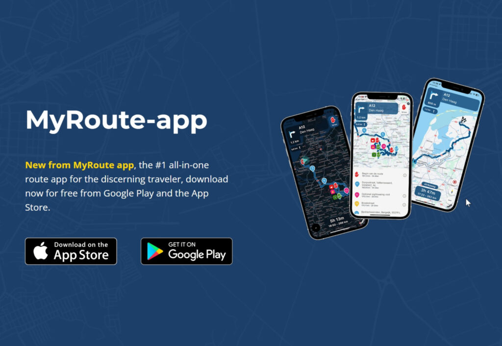
The MyRoute App is Apple Carplay and Android Auto compatible which is tech I will have on my next bike I personally own. In remote Australia I found the lack of phone towers limited my ability to use Apple Carplay in my previous testing before the device from Aliexpress failed but I liked the system and will have a better setup next time or possibly a bike with a factory Apple Carplay screen. In Australia when I lost signal and data it did not really matter because there is just one road ahead to the next town with signal and actually I can tour here without any navigation so it is just a bonus or fun gadget to have unlike overseas where reliable navigation is important or in places like Japan absolutely essential.
I like how MRA Routerplanner has Google Street view implemented, which is faster display than RWGPS. MRA also has more maps that your can choose than RWGPS. It defaults to OSM and of course you can select Google maps but I have been using the Michelin maps which I think is unique to this planner and is superb for my task. It has this great feature that all the scenic roads have been highlighted in green. This is changing how I build routes. I still look at good road sites like Motorcycle Diaries and then transfer that info to my route but in between their ‘best motorcycle roads’ I can instantly see all the highlighted scenic roads on the Michelin map to connect one mountain pass to the next with nice roads.
I should point out that to get all the features you need to buy the Gold account but this is far better value than RWGPS where I pay an annual fee for my premium account but with MRA Routeplanner I got lifetime Gold access when it was on sale for the same price as just one year of RWGPS premium. Both of these sites have a large user base which is something also to note as smaller route planner sites tend to come and go and you do not want to be with a site where you will lose all your routes.
Anyway I am not saying either of these planners and their navigation apps is right or wrong for you. I am not affiliated with either. But I have recommended RWGPS on this site for a long time so felt I would post that I am transitioning to MRA Routeplanner because I found RWGPS had slowly become too bias towards bicycle riders. I find MRA outputs GPX files more accurately for motorcycling, has map overlays more useful for motorcycling and has a phone navigation app better designed for motorcyclists. YMMV.
Update 2025
Well it was a drawn out process but I have finally stopped using Garmin GPS’s and now am navigating with a 2nd phone I purchased solely for this purpose which currently is an OPPO A40. This has a large bright screen easy to see even in direct sunlight and has a large battery and no drama trying to use phone as camera as I can quickly access my regular phone in my pocket.
I am using MRA now for my navigation and it is superb, much better than my Garmin once I learned a few tricks. The key thing to know is it has waypoints that can be bypassed by the rider or by the navigation app in some cases and via points which cannot be bypassed.
The start point is a via point, if you do not specifically ride over this then MRA will try re route you back to it endlessly so a good thing is to place it carefully or in the morning select skip this point in the app. During your day if you must visit a place make it a via point, if you want the app to make smart routing choices in a city then choose way points.
The app provides excellent advance guidance for lanes and junctions (via voice prompts to bluetooth headset). I found it effortless to navigate big cities with it compared to other apps I have tried and its vastly better then Garmin’s. There are settings to increase the notifications given and then it’s even better than Google as far as giving advice on where to be in lanes and what is coming up.
It has been great on advising me for speed cameras and speed zones in Europe which was critical riding in countries with steep fines.
I have not been so successful with getting MRA to re route me at a road closure. Much like Garmin’s it said go back the way I came then turn around and come back to the same road closure. In this situation I had to get Google to re route me and that requires finding a place to stop and taking off gloves and fair bit of messing about.
A Garmin in this situation is actually far better (despite also being dumb as far as re routing) because you can simply switch from birds eye navigation view to the map and then pan/scroll to see the nearest side roads or alternative route then tap to add a new destination or via point then the Garmin will navigate to there – all this can be done without needing to stop and remove gloves as screen is designed to be glove friendly.
Another case where I had to re route was in Norway when it was pouring rain and again I had to stop and remove gloves and fire up Google then had difficulty getting damp hands back in gloves and again in that scenario a Garmin would have been easier to use just switch to map view no need to remove gloves.
There perhaps is a easy way to do re routing with MRA, I am still learning about it, also one of those tablet touch pens would make accessing everything on a phone screen with small buttons possible with gloves on.
I actually tried a new Garmin XT2 but it was such a terrible device so many bugs it was unusable and that was what made me commit to leaving Garmin behind which now I am glad I have done.
As far as planning my routes I am still doing my rough draft routes initially in RWGPS. Just because it is so fast to create routes in the desktop version of this. With RWGPS planner when creating new routes you can stay on same map view and clear the current route then start on next days route – with MRA route lab to create new route I need to click that then it takes me to my home town then I have to pan out and scroll across the world and zoom in until I find the hotel from previous days route to start making new route, and I have to do this for every new route.
I sometimes make 3 or 4 versions of my initial rough route so I am going to keep doing that in RWGPS desktop and export my routes to MRA Route Lab once I decided on my preferred draft riding route then I will refine each day of the ride further in MRA.
I have not been back to test MRA in Japan and that is a country where having the latest road map info is essential. If I go back I think I would use Google maps navigation for the tollroad network in cities as it is going to be more up to date than OSM map data used by most of the other apps but the majority of any tour I did there I would be in the countryside and I feel MRA would be fine for that task.
If I was based in Japan again I’d still consider buying a new Garmin just for Japan because the model sold there has the superb split screen with junction graphics for the Japanese toll road network as well some other Japanese only features and with there being so many road closures in Japan being able to re route on the fly is very handy but that’s only country I’d have another Garmin.


Hi Warren! I got the chance to meet the developers of MRA in Amsterdam and they are great guys and you can see they are bikers themselves, using the product they made and with a lot of passion into it.
Before they developed Tyre to Travel, which was also great and I still use sometimes, but MRA is the future. Being able to plan the routes on any PC or phone online is very cool.
PS: I tried to send you an invitation on the site, not sure if it went through, hope you dont mind.
Hi Adrian,
I got your friend request on MRA, thanks very much.
The more I use MRA the more I find it to be a better fit for motorcyclists.
Hi Warren
I am something of a tech dinosaur 🦕 and currently use the Garmin-based BMW Nav 6 to navigate my way around Europe on my BMW 1250 RT. Having read a great deal about the MRA Routeplanner software it sounds great but, do you know how easy is it to transfer routes to the Nav 6? I do on occasion use Google maps on my phone.
Hi Richard,
You can import .gpx route files to the Nav 6 via USB cable from your computer.
Once your Garmin is connected the MRA web site there is a menu item to transfer your route to the Garmin, or you can also do it manually.
To do that connect PC to Garmin via USB then copy your .gpx route file already saved on your computer to the Nav 6 ‘GPX’ folder.
Either way when the device reboots it will find the .gpx file automatically and ask do you wish to import new route.
If you transfer many routes to the Garmin in one go (like a 10 day tour of routes) then the Garmin might only import 3 then stop.
In this case or if it doesn’t automatically find the files you can make the Garmin find them manually.
To do this you go to the Nav 6 menus and find the My Data menu then select import routes but 99% of time it will automatically find the files soon as it is disconnected from your PC.
Hi Warren
i just came across your website today, congratulations! the amount of trips you have done across Japan are just amazing.
I live in central Tokyo (Nakano), will get my first motorbike in Japan (Honda NC750x DCT, just to make things easier; owned Moto Guzzi when i was in Italy) and looking forward to explore a little Japan. In your opinion, is MRA app the best one to use? as i don’t want to get lost while trying to get out of Tokyo, is the navigation accurate when arriving at any cross roads ?
thank you
alessandro
Hi Alessandro,
In Japan I used a Garmin Zumo 660. Currently I have been using MRA and Ride with GPS app overseas.
I like the map display of MRA better than RWGPS but so far cannot say it is superior.
I have had some issues getting MRA working offline while RWGPS has navigated me perfectly on my last three tours.
I need more time using MRA which I will get shortly as I am heading to Europe this week and will try MRA first but have all my routes also in RWGPS as a backup.
Quite a few expat riders in Japan use Ride with GPS so I would suggest having a look at it and see how it’s junction guidance works there and if not good enough then swap to MRA.
Hi Alessandro, I’m nobody but I do live in Japan and this site helped me get started. As Warren mentions in another comment, probably your best bet for getting out of Tokyo will be Google Maps. Once you’re outside the city, you can rely on other programs.
When I’m out in the countryside, I sometimes use OSMand if I want to make a route. The frustration with Google Maps is that it will recalculate even if you make one wrong turn, or if traffic conditions change. On the other hand, Google Maps is excellent for getting in and out of the city. I’d never needed a GPS back in the US—even in the big cities I could always manage. I tried to rely on OSMand once or twice to get out of Tokyo and it was a disaster for me.
Regarding the differences between RideWithGPS and MyRoute App, I’m not qualified to comment. I would sometimes create routes on my PC with RWGPS and export them to Google Drive, then import to my phone into OSMand. That works okay for me, but overall as Warren says RWGPS seems to be geared more for bicyclists, and ultimately I found the yearly subscription cost to be not worth it (for me).
Anyhow, good luck. To this day, getting out of and back into the city is painful no matter what method you’re using. (But this was true back home as well.) One bit of advice: get an ETC card if you don’t have one, and get used to to the fact that you may have to use the exorbitantly-priced tollways to get in and out of the city if you’d like to preserve your sanity. Sorry for the long bit of unsolicited advice.
Sorry I will add an update to this post above.
I have transitioned to MRA now and used it successfully on tour and retired my Garmin.
Dear Warren
thank you for your very prompt reply. i guess the Garmin would the best in term of navigation, although it is quite pricey. The one you had in Japan, did you bought it there? was it in English? i don’t want to buy something where it is only in Japanese, i would not too far 🙂 ; on the other hand i was thinking on a monitor with carplay on it and with a rear dash camera; i am a little concern on getting out of Tokyo.
i checked out the Ride with GPS, it is basically for bikes, anyway, will play around with it and see how it work.
Enjoy Europe, hope you can do the Stelvio pass with the motorbike 🙂
Hi Alessandro,
Yes the previous model Garmin’s were good but expensive. You had to buy them in Japan to get the Japan map but they could be changed to English.
However at that point in time the phone apps were not as good as they are now so people who were doing a lot of touring could kind of justify the cost.
Now I think that is no longer the case. Also the current model Garmin XT2 is very bug ridden while apps have gotten much better.
Another suggestion is use Google Maps navigation to get out of Tokyo.
i.e. select a place where you are leaving the expressway system like a 7/11 or Family Mart or gas station just off the expressway on way to mountains you will be touring then let Google navigate you from home to that point.
Google gives good junction advice. Do you have a headset, getting voice lane prompts is really helpful in Tokyo and at highway junctions. Even just pair of low profile bluetooth earbuds can be used. Once out of cities on country roads everything becomes simple and RWGPS would definitely be enough. Then end of day use Google again to get you home or to your hotel if on multi day ride. RWGPS may look like it is for bicycles but the two developers are both motorcyclists and when you select motorcycle mode the navigation works very well.
That is probably what I will do when I get back to Japan touring as I no longer have my Japanese Garmin (was lost in shipping) and I would not buy another.
Google on the expressway and MRA or RWGPS for the countryside where Google is not so useful as it wants to take you always on fastest route.
Hello Warren,
What to think of this app which don’t let you cancelling your account, pretending your needed password is wrong, ( which is bullshit )?
Have you reached out to the Admins in the user forum for assistance?
The owner is very active on Facebook so perhaps you could also elevate the matter if no help was forthcoming from the forum.
Personally I will keep using MRA for my European rides, I paid a one time licence at sale price so am not too disappointed that it doesn’t work for Asia, but the developer is missing a chance to make the app much more widely used and get all the RWGPS users to migrate over.